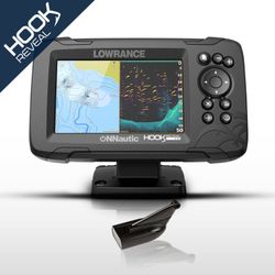
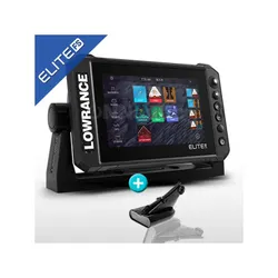
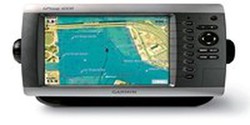
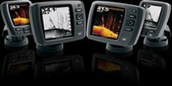
Lowrance HOOK Reveal 9 HDI 83/200 PoweryMax Ready GPS Plotter Probe
Brand: Lowrance
Reference:
Description
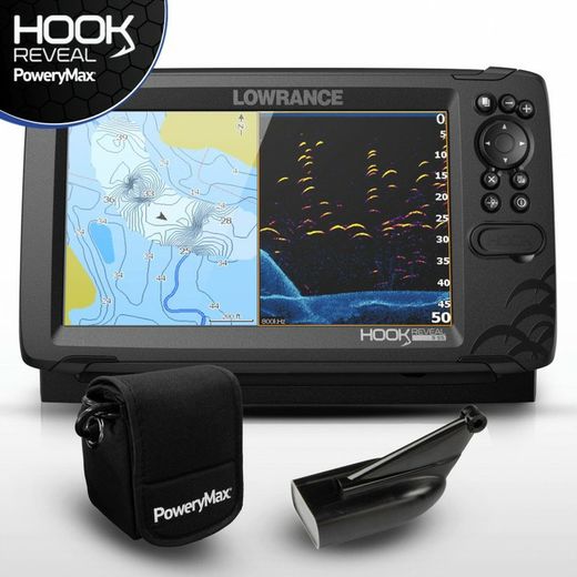
From the world's best-selling probe series, Lowrance launches an evolution called Hook Reveal 9 HDI 83/200 + Downscan with a 9-inch screen and 300w power, highlighting two features such as the FishReveal (intelligent target detection) and the Genesis Live (bathymetry in real time). Powered by the prestigious PoweryMax PX10 lithium battery, ideal for kayak, duck and boat without battery.
Details
- Lowrance Hook Reveal 9 HDI GPS Plotter Probe.
- Stern transducer HDI 83/200 kHz 455/800 kHz Medium / High / CHIRP / DownScan 300W.
- Lithium Ion PoweryMax PX10 battery
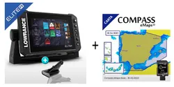
- Optionally you can buy Compass cartography, to choose between Compass eMaps Basic and Compass Large, both at an exceptional price per purchase in Pack.
The new Hook Reveal GPS plotter manages to combine the search for fish by intelligently identifying the Lowrance CHIRP sonar targets together with high-resolution images of the bottom structure and all its details obtained using DownScan Imaging ™.
Thanks to this, the best fishing view is merged on the same screen, identifying fish much more easily and how they interrelate with the structure of the seabed without the need for a split CHIRP-DownScan Imaging ™ screen. Thought and designed to make the most of your time in the water and fishing.
SolarMAX displayThe 9-inch SolarMAX ™ screen allows a wider viewing angle from any point of view, thus avoiding annoying reflections of sunlight during our fishing days.
Using the Autotunning Sonar option, you will spend more time fishing and less time setting up the Hook Reveal, as it automatically adjusts itself as fishing conditions change even in deeper water and with a wide probe coverage beam.
- FishReveal ™
- Genesis Live Mapping in real time
- Self-adjusting probe
- HDI 83/200 Transducer with CHIRP Medium / High and DownScan Imaging ™
- Preloaded world basemap
- SolarMAX ™ display
- New color palettes to find fish
- Optimized keyboard with one-touch access to key functions
- Optional compatible mapping of different brands Compass eMaps, C-MAP, C-MAP Genesis, Navionics® and more
- MicroSD card slot
- Easy flush mount (with optional kit) or bracket
- Improved sonar performance in deep water
FishReveal ™ technology or intelligent target detection enables all targets to be viewed quickly and accurately by combining the traditional fish finder with CHIRP technology and DownScan Imaging ™. Thanks to the high resolution, we will be able to locate the target fish more clearly on screen with respect to the structures of the seabed or even within the schools of grass fish.
Creating your own real-time mapping is made possible by the Hook Reveal 9 HDI 83/200 / Downscan, updating the mapping of your regular fishing spot with ½ foot contours and saving it instantly to your microSD card pre-inserted into your Lowrance HOOK Reveal 9 HDI 83/200 / Dowscan. Lowrance's exclusive Genesis Live technology will allow you a number of options with which you can create and customize, such as controlling the transparency and density of the contour, the depth, the safety shading color palettes and much more.
The HDI 83/200 transom transducer + DOWNSCAN 455/800 compatible with CHIRP technology included in the pack, offers a viewing angle of 52º in Medium CHIRP and 22º in High CHIRP, as well as a DownScan 455 / 800khz probe for scanning fish and distinguish all the structures under your boat.
Without a doubt, one of the best quality / price ratios on the market in transducers that has 6 meters of cable sufficient for the vast majority of installations.
Probe / DownScan frequency range:
- Chirp High / Medium
- 83/200 khz
- 455/800 khz in DownScan
Its reading beam provides great detail of fish at great depths.
3. Lithium Ion PoweryMax PX10 BatteryBATTERY CONTENT
- PoweryMax PX10 Portable Battery. Very light, with waterproof, safe and long-lasting protection.
- 220v smart charger.
- HOOK Reveal / PoweryMax Ready Power Cable.
- 12v. / 10Ah.
- Weight: 650 gr.
PoweryMax has been based on a core of Lithium Ion cells of the highest quality, to develop this product under the criteria of maximum efficiency and usability, which with just 650 gr of weight, allows it to be carried anywhere on the boat, kayak or duck.
Its internal cells and protection system are kept safe from water ingress thanks to a fully sealed silicone-based cover and wrapped in a portable neoprene sleeve that will allow you to carry it without fear of getting it wet. The connections are completely watertight thanks to the use of gaskets and threaded connectors.
OPTIONALS: Expand your team.
- Mapping Compass Guadalquivir Basin
- Cartography Compass Lago Alqueva
- Cartography Compass Cuenca del Guadiana
- Cartography Compass Portugal Continental
- Cartography Compass Spain Atlantica and Canary Islands
- Cartography Compass Spain Mediterranea
- Navigate with precision: enjoy the most extensive and detailed Bathymetric maps by geographical area.
- Plug & Play: connect your card to your device and browse. Don't waste time with boring software updates. Connect and browse.
- Navigation assistant: easy to use and intuitive. Information about the environment, such as structures (bridges, submerged bridges), warnings (forbidden or shallow navigation area), depth data, etc.
With the Compass eMaps Basic cartography, you will enjoy a reference map of the sea waters of the Iberian peninsula as well as the Canary, Balearic, Madeira and Azores archipelagos. In addition, the shore contour of the main inland water bodies is included on a single card.
Do you want a more detailed Bathymetric level?Then choose the Compass eMaps Large cartography of the area that suits you best at an unbeatable price, whether it is sea or inland waters.
